道路
Roads Default model
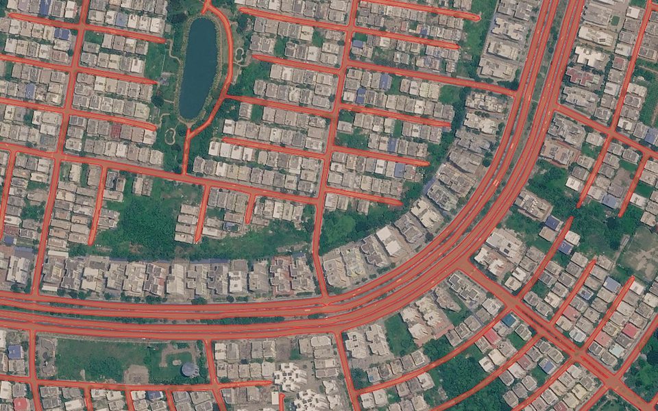
示例结果:基于清理后的中心线网络生成的道路多边形。
费用
每 km² 5 积分 + 影像
示例:Mapbox 缩放级别 18 下 10 km² ≈ 80 积分。
识别道路中心线,清理路网图(简化几何、合并断口、移除重复边和短小孤立段),再转换回道路多边形。多任务学习可在树木或建筑遮挡道路处保持路网连通。
输出结果
基于清理后的中心线网络生成的道路多边形。
最佳适用影像
适用于 0.6–0.3 米影像(缩放级别 18)中的农村和郊区。人行道宽阔、路口复杂的密集市中心难度更大。
使用示例
为乡村规划绘制通行道路和便道
补充 OSM 中缺失的林道和田间道路
核查新建郊区的街道网络
- 版本
1.1
- 地理范围
全球,农村和郊区效果最佳
- 方法
分割 + 路网图后处理
- GSD / 缩放级别
0.6–0.3 m / z18
工作原理
该模型主要基于农村和郊区数据训练。多任务学习可在树木或建筑遮挡道路处保持道路掩膜连通。在道路宽阔、有人行道且路口复杂的城市中可能失效。
模型先提取道路中心线以减少杂乱,清理路网,再将线条扩展回道路多边形。自 1.1 版起,道路路网图会进行后处理:
几何简化;
合并断口;
去除双边;
移除孤立和过短的路段。
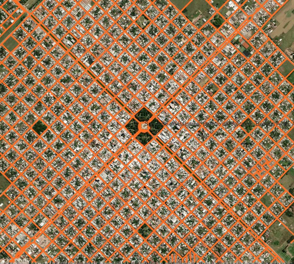
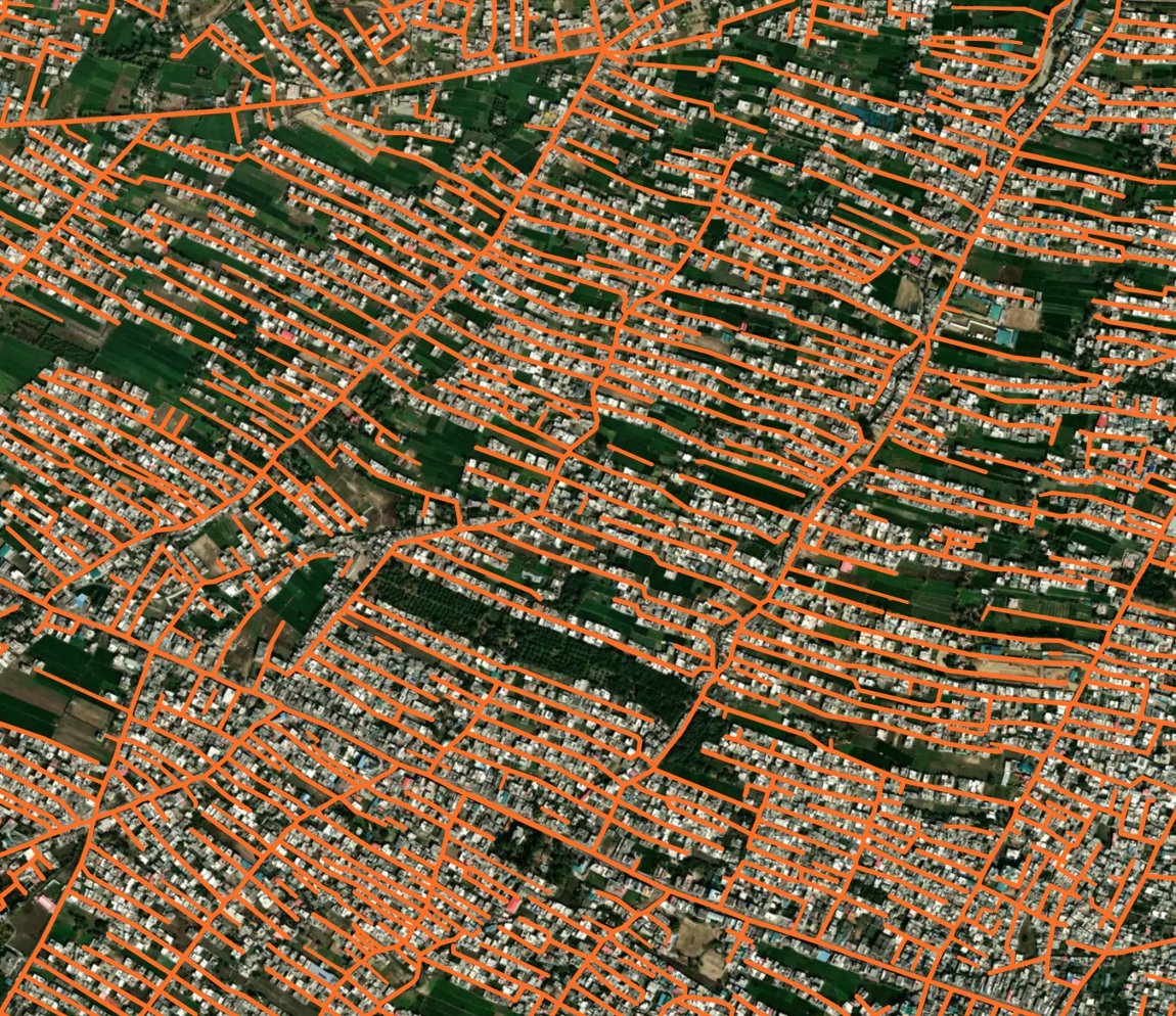
示例结果
📊 Benchmarks
We evaluated the update using open benchmark datasets, including SpaceNet 3 Roads, supplemented with our own validation data across different urban environments.
We focused on two complementary metrics:
IoU (Intersection over Union) measures how accurately the predicted road mask matches the actual road coverage. It tells us how well the model identifies roads and captures their spatial extent.
Topology F1 (Topo-F1) evaluates the connectivity of the extracted road network. This is particularly important for mapping and routing, where roads need to remain connected even when partially obscured by vegetation, buildings or shadows.
The new model improves both metrics across all seven validation datasets. Compared with the original baseline, the average scores across these datasets increased significantly:
IoU: 0.386 → 0.599 (+55%)
Topo-F1: 0.465 → 0.758 (+63%)
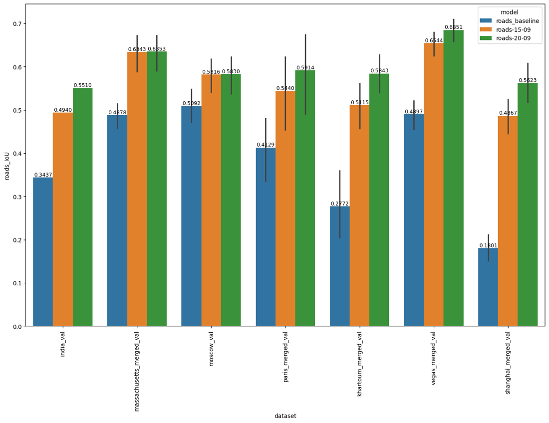
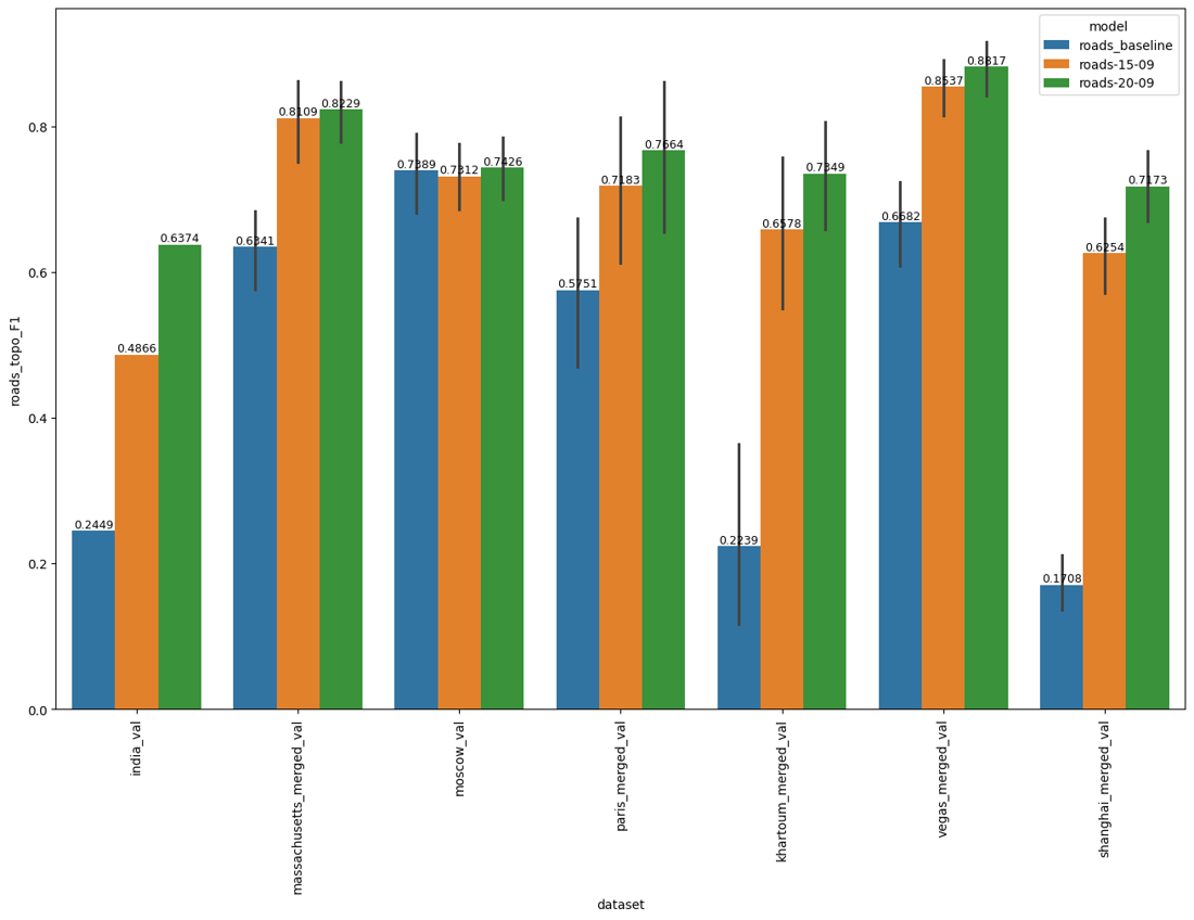
Some of the most impressive improvements are in challenging urban environments:
Validation area |
IoU (before → after) |
Topo-F1 (before → after) |
|---|---|---|
Shanghai |
0.180 → 0.562 |
0.171 → 0.717 |
Khartoum |
0.277 → 0.584 |
0.224 → 0.735 |
India |
0.344 → 0.551 |
0.245 → 0.637 |
Las Vegas |
0.490 → 0.685 |
0.668 → 0.882 |
Why do both metrics matter?
A road network may look connected but still miss substantial portions of the actual road coverage. Conversely, a model can accurately identify individual road segments but fail to connect them into a usable network.
The updated Roads model makes progress on both fronts: more accurate road coverage and better-connected networks. This is especially valuable in densely built-up areas with narrow streets, irregular layouts and frequent occlusions — precisely where automated road mapping remains challenging.