Segment Anything
Other objects On request
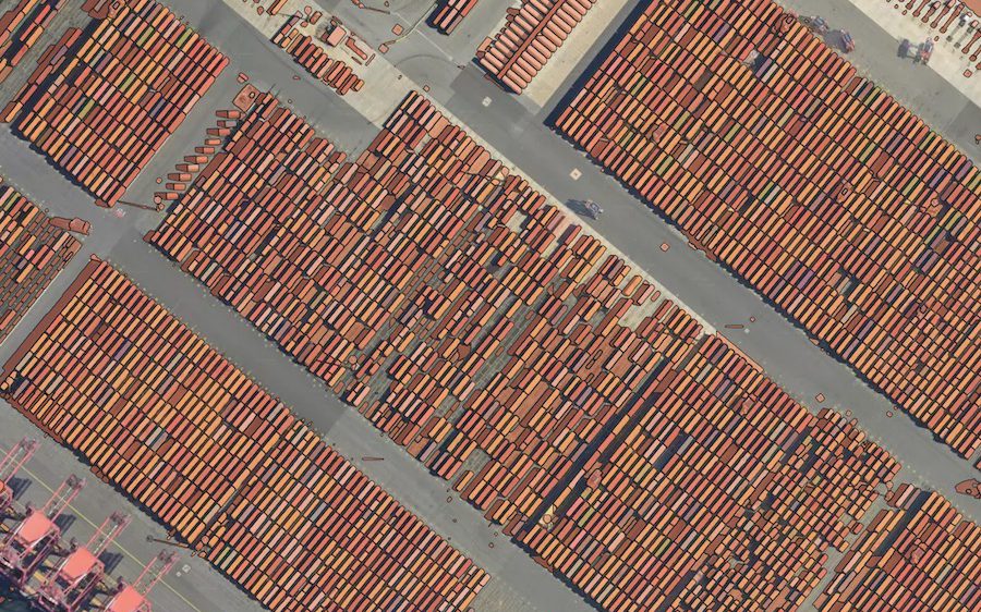
Example result: SAM at zoom 16.
Cost
Priced per project
Request access and we connect the model to your account.
Meta’s universal segmentation model, adapted to Mapflow workflows. Zoom 14 outlines land use, large fields and water; zoom 16 small fields and large buildings; zoom 18 farms and groups of trees; zoom 19 and up houses, trees and vehicles.
What you get
Polygons of whatever stands out at the chosen zoom.
Works best with
Any RGB imagery. Choose the zoom in the run form.
Usage examples
Outline objects no standard model covers
Pre-segment imagery for manual labelling
Explore a new area before choosing a model
- Geo domain
Global
- Method
Universal segmentation
- GSD / zoom
z14–20
Note
This model is no longer a default model. It is available on request.
How it works
The “Segment Anything” (originaly introduced by Meta as universal segmentation model) is available as yet another experimental model in Mapflow. We adjusted it to Mapflow workflows to be used on a scale. There are the same steps required to launch this model:
Select your data source
Select your geographical area - either polygon, GeoJSON file, or your image extent
Yet there is one difference in the model workflow:
if you run this model using GTIFF file — the original resolution of the image will be used
if you run it via TMS (e.g. Imagery like Mapbox Satellite) — you need to select the Zoom level (image resolution) from the model options which will be used for the input
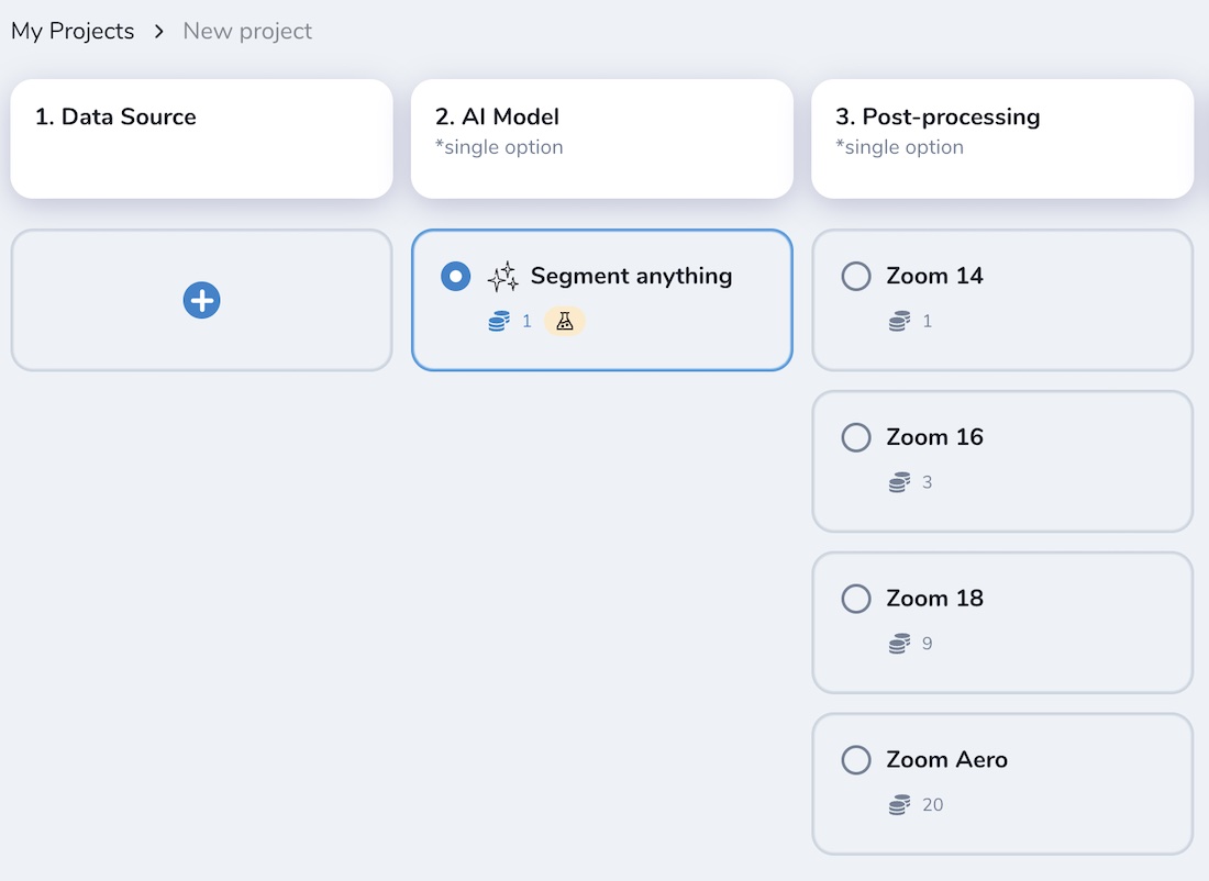
Depending on the input resolution, the SAM model will interpret and generate different results. It can be empirically classified by mapping classes depending on the zoom levels as follows:
ZOOM LEVELS |
SEMANTIC OBJECTS |
|---|---|
14 |
Land use, large agri fields, forests, parks, fields, bodies of water |
16 |
Small fields, large buildings, lawns, plots |
18 |
Farms, buildings, groups of trees, etc. |
19+ |
Houses, trees, vehicles, roof structures, etc. |
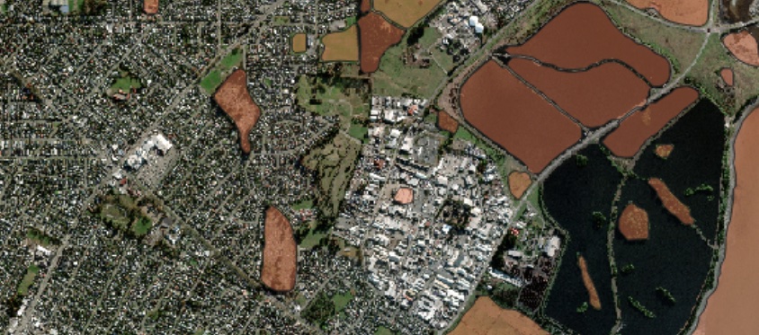
E.g. Result – SAM (zoom 14)
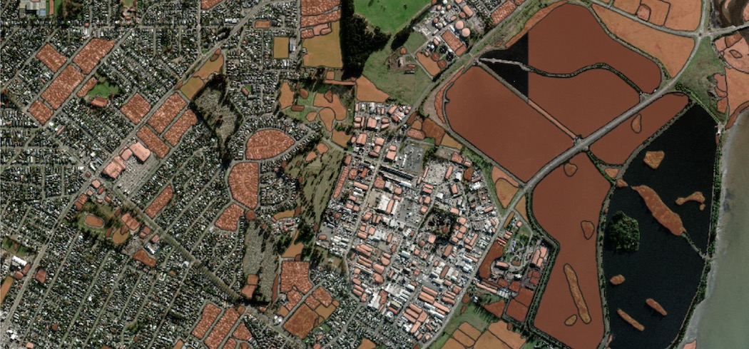
E.g. Result – SAM (zoom 16)
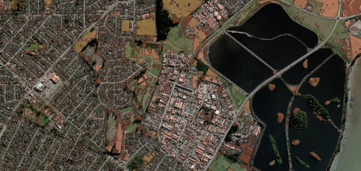
E.g. Result – SAM (zoom 18)
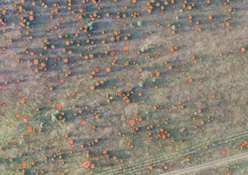
E.g. Result – SAM on aerial imagery (zoom 20), single trees. Some polygons are not very accurate and some target objects are missing, but the overall result is relevant and can be used for more accurate mapping.
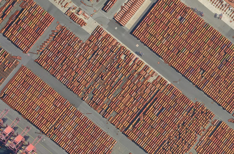
E.g. Result – SAM on aerial imagery (zoom 20), containers. Applicable to small similar-pattern objects, requires some manual filtering of the model’s output.
Note
SAM is not provided in Mapfow for QGIS list of default models, as the zoom options are not enabled in the current plugin’s design. Yet if you work in QGIS and want to try SAM there — send us a request and we will connect corresponding workflow scenarios with all zoom options specified.
Need a different object?
We train custom models on your imagery and classes, and connect them to your Mapflow account.