Solar panels
Other objects On request
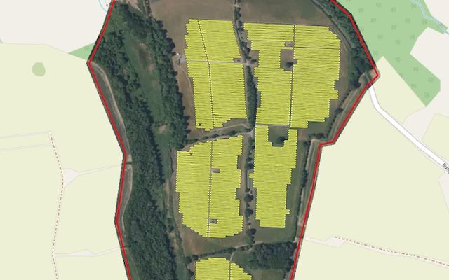
Example result: rooftop and ground-mounted panels.
Cost
Priced per project
Request access and we connect the model to your account.
A detection and segmentation model for photovoltaic panels, trained on aerial imagery. It finds panels on rooftops and in solar farms.
What you get
Solar panel polygons.
Works best with
Aerial imagery at zoom 19–21.
Usage examples
Inventory rooftop solar in a municipality
Monitor solar farm build-out
Estimate installed panel area for grid planning
- Geo domain
Global
- Method
Detector + segmentation
- GSD / zoom
z19–21
- Test score
Pixel-wise F1 > 0.77
Need a different object?
We train custom models on your imagery and classes, and connect them to your Mapflow account.